The Bay, by rail.
Caltrain, BART and Muni on one iPod. Live times, a trip planner you can talk to, and an egg timer that rings before your stop.

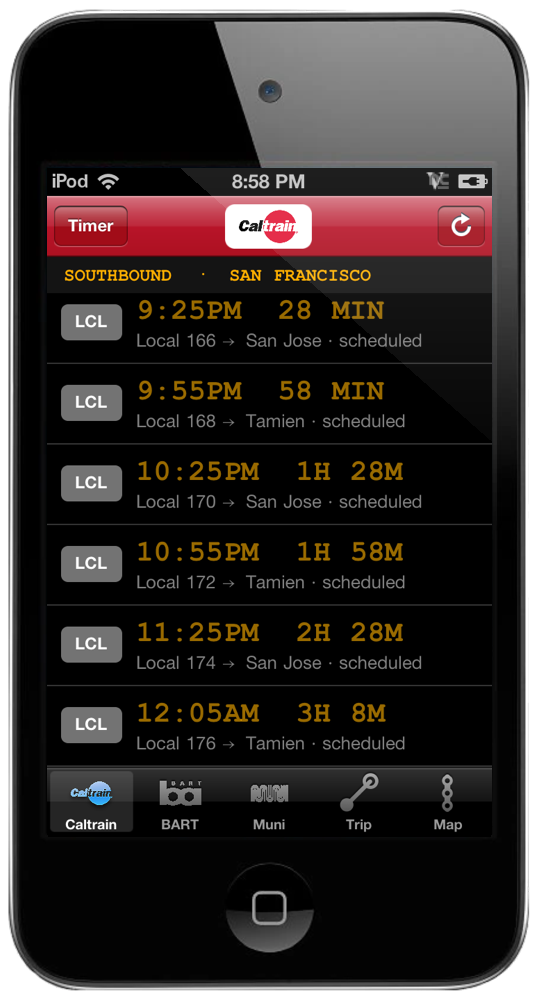
Pick your station once. The next trains come up like the board on the platform: local, limited or express, the minutes until it leaves, and whether it's running late. Bright means live, dim means timetable. Service alerts sit at the top.
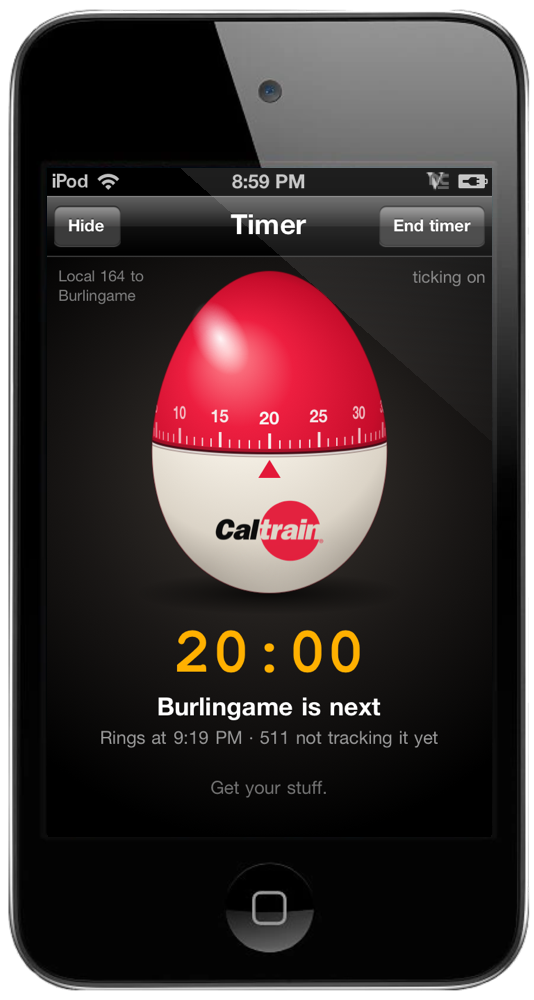
Say where you're getting off and a Caltrain egg timer winds itself to the minutes you have left. Then put the iPod away. It rings a minute before your stop, even with the screen locked. While it's open it watches the train's live times from 511, so if the train runs late the ring waits with it. A minute too close? Make it two, three or five in Settings.
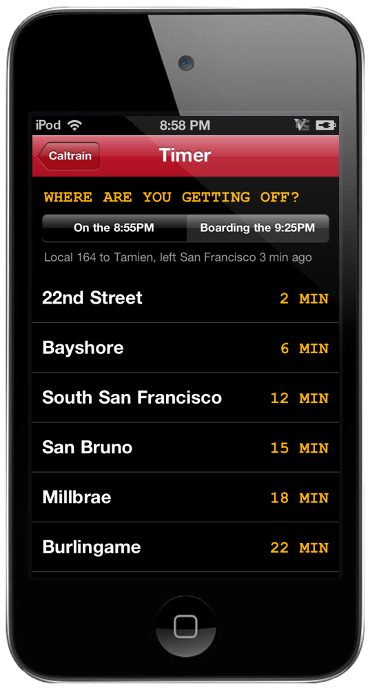
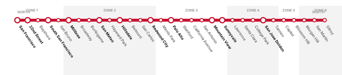
Tap Timer on the board. It works out which train you're on, the one that just left your station or the next one in, and lists every stop ahead with the minutes to get there. Tap yours and that's it.
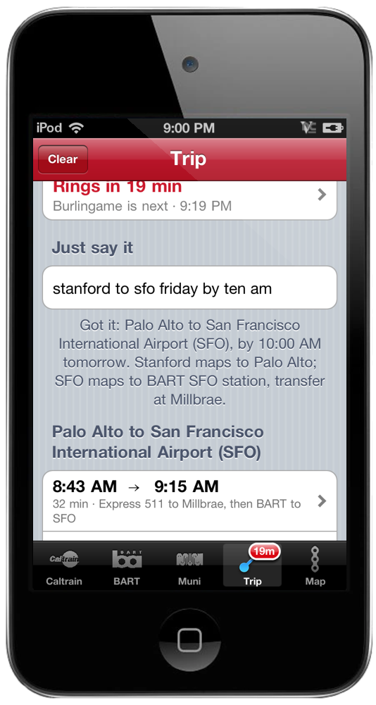
"stanford to sfo friday by ten am." OpenRelay works out the stations, the day and the time: Stanford is Palo Alto, and SFO is the BART station. The Caltrain timetable and BART's schedule pick the trains, so every time you see is a real one. No typing station names into boxes.
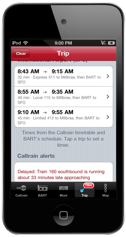
Every way there, earliest first, with the ride time and the trains. Caltrain, BART, or both, changing at Millbrae. Tap one for the route.
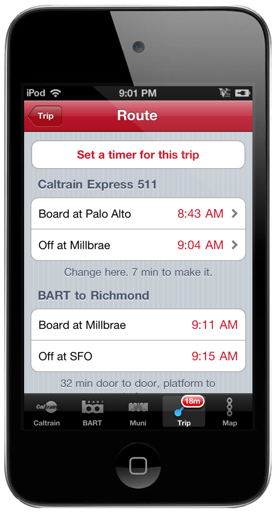
Every leg of the trip: where to board, when to get off and how long you have to make the change. Set a timer for the whole trip and it rings before every stop where you get off. It can ring when it's time to walk to the station, too.
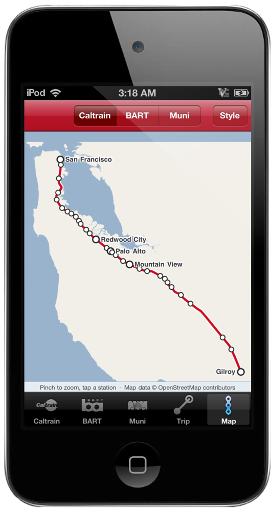
A real map of the Bay drawn from OpenStreetMap shoreline in the colors of the old Maps tiles, with the Caltrain track, every BART line in its color, and the six Muni Metro lines. Pinch to zoom, tap any station and its board slides in. No tiles to download, so it works in a tunnel.
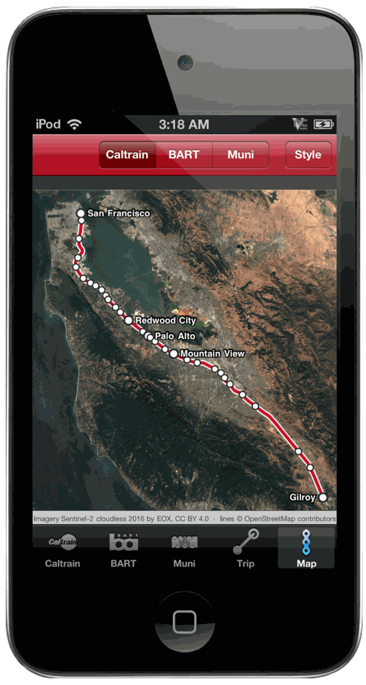
Standard is the beige-and-blue of the Maps app of the day. Satellite is Sentinel-2 cloudless imagery of the whole Bay (EOX, CC BY 4.0), with USGS aerials for the city, baked into the app so it never needs a download. Night turns the lights down and the lines up. Pick one from the Style button and it sticks.
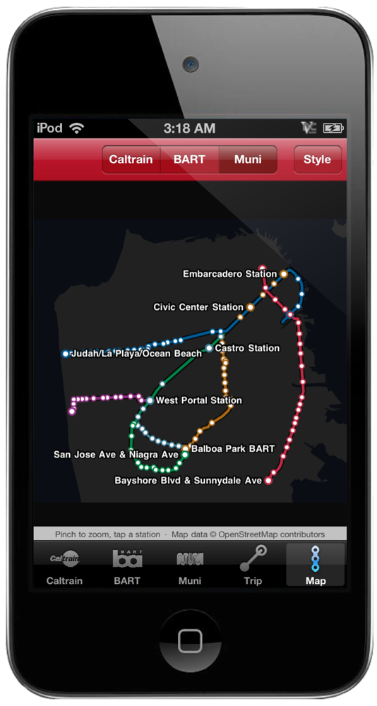
The six Muni Metro lines in their colors on the night map. Every stop is a tap away from its live arrivals.
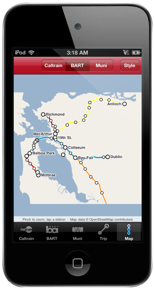
Pick any of the 50 stations and the board fills with the next trains, the line color, platform, car count and how late it's running. It refreshes itself every minute while you look at it. Plan a trip and BART's own planner answers with transfers and the Clipper fare. Every line is on the map in its color, and tapping a station opens its board.
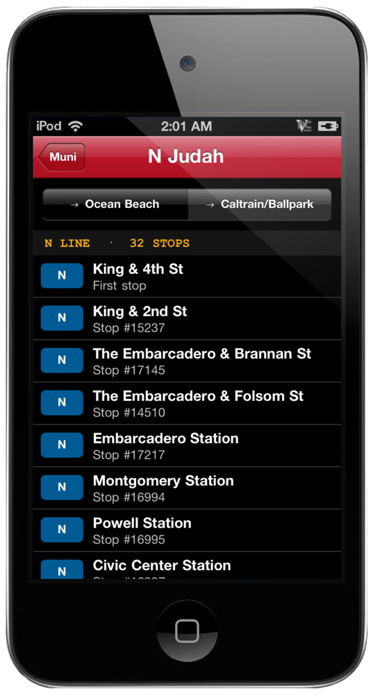
J, K, L, M, N and T with every stop in order, tap one for the next trains and save it. Or type the stop number from the pole and it's on your board for good, with the next arrivals for every line that stops there. Buses, Metro, cable cars. All 3,240 stop names are built in so you know you typed the right one. Tap an arrival and twist the egg timer to it yourself.